When it Floods It Destroys – 1908 Trinity River – 1921 San Antonio
Welcome to Episode 76 – When it floods it destroys – 1908 Trinity River – 1921 San Antonio. Today I’m looking at one of the more silent disasters that can hit a state and that is flash flooding and flooding in general. If you don’t mind how about visiting my sponsor Ashby Navis & Tennyson Digital Publishers great audiobooks, mobile apps, and video games.
Podcast: Play in new window | Download | Embed
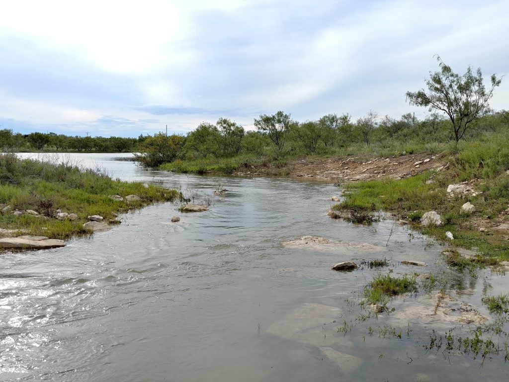
Picture a dry creek bed or a street that looks calm and harmless. Then, suddenly, heavy rain falls—sometimes miles away—and all that water rushes downhill at once. In minutes, what was once dry ground can turn into a roaring river.
That’s a flash flood.
Unlike regular floods, which rise slowly over hours or days, a flash flood lives up to its name: it happens fast, often with little warning. Walls of water can sweep through canyons, streets, or neighborhoods, carrying debris, cars, even parts of buildings.
A flash flood is nature reminding us just how quickly things can change. One moment calm, the next moment a surge of unstoppable water. It’s powerful, dangerous, and one of the hardest types of flooding to escape—because it gives so little time to react.
1908 Trinity River Flood (Dallas)
Stretching from a few miles south of the Red River the Trinity River runs for 710-miles. As the river ran through Central Texas, the Caddo people called the river the Arkikosa and as it neared the Gulf Coast it was known as the Daycoa.
In 1687 French explorer Robert Cavelier de La Salle, named the river Riviere des canoës (“River of Canoes”) and then in 1680 Spanish explorer Alonso de León named it, “La Santísima Trinidad” (“the Most Holy Trinity”).
However, in 2022, language preservationists from the Caddo Nation determined their ancestral language lacked the letter “R” sound. So that means that the original Caddo name, Arkikosa was likely a corruption or misspelling of the word Akokisa. That word was actually taken from the language of the Atakapa people who lived in the woodlands along the Gulf Coast.
The river passes through the cities of Dallas and Fort Worth and is and was a major waterway in the region.
Anyway, about the flood….
In the spring of 1908. rain had fallen for days, soaking the earth until it could hold no more. By late May, the Trinity River was no longer a river, it was a roaring, unchained sea. On the morning of May 24, the people of Dallas awoke to a sight they would never forget: the river had swallowed nearly a third of their city.
Homes in the bottoms lay under brown, swirling water. Families scrambled to rooftops with what little they could carry, waiting for boats to pull them to safety. The wooden bridges that once connected Dallas to Oak Cliff were gone, swept away like twigs. With rail lines drowned and telegraphs silenced, the city stood alone, an island cut off from the world.
At its height, the Trinity surged more than fifty feet above normal. The flood took lives, at least a handful, records from that time period are scarce, so there may have been many more who lost their lives. We do know that thousands were left homeless. Livestock drowned in the fields, businesses were ruined, and the muddy water lingered long after the rain had stopped, reminding everyone of the river’s power.
Yet out of the wreckage came resolve. Dallas leaders saw clearly that the Trinity could not be ignored or left to its own wild course. Within a few years, levees would rise, the channel would be straightened, and a grand new bridge, the Houston Street Viaduct, would span the river, a promise that Dallas would never be humbled in the same way again.
13 years later, South Texas would experience much the same from the San Antonio River and its tributaries.
1921 San Antonio Flood
For 23 straight hours the rain came not from San Antonio’s skies, but from the Hill Country beyond. On September 9, 1921, torrents fell upstream, and the unsuspecting city slept as the water gathered strength. By dawn, the San Antonio River and its tributaries were raging walls of water. Streets became rivers. Entire neighborhoods disappeared under the flood, and families clung to treetops or roofs in desperation.
A thousand acres of the city were flooded. A three-quarter square-mile area of downtown was covered by two to twelve feet of water.
Floodwaters ripped through the city’s predominately Mexican West Side neighborhoods, killing more than eighty people. Many of them in the neighborhoods along San Pedro and Alazan creeks and their tributaries.
Meanwhile a wall of water crashed into the central business district on the city’s North Side, wreaking considerable damage. The wall of water swept through the streets and tore through structures, including city hall, police headquarters, and hospitals. The flood inundated downtown with up to twelve feet of water in some areas.
Despite at least 500 rescues, many by soldiers mobilized from nearby United States Army posts, more than 200 souls were lost, swept away in what became one of Texas’ deadliest floods.
In the aftermath, the city vowed never again to be caught unprepared, but it took nearly three more years for flood prevention plans to be finalized and for $2.8 million in municipal bonds to be approved so work could start. The city hired Samuel F. Crecelius, retired from the U.S. Army Corps of Engineers, to supervise the overall project. Olmos Dam finished in 1926. Downtown, floodwaters would be diverted into a straight path to avoid the politically sensitive Great Bend, also known as the Horseshoe Bend. Floodgates at both ends of the Great Bend would seal it from floodwaters. The bypass channel was completed in 1930. The city’s response to this disaster shaped its environmental policies for the next fifty years, carving new channels of power. Decisions about which communities would be rehabilitated and how thoroughly they were made in the political arena, where the Anglo elite largely ignored the interlocking problems on the impoverished West Side that flowed from poor drainage, bad housing, and inadequate sanitation.
To this day, San Antonio’s West Side, while not being as ignored as it was then, often goes underserved in favor of services being diverted to the wealthier North Side of the city.
Next episode we’ll move the calendar up to 1935 a few years after the great depression and while the world was recovering, 1935 proved to be a very wet and disastrous year for many in Texas. I’ll see you then.